Live Traffic Camera: FM92 @ FM418 - Silsbee (North)
Silsbee, Texas
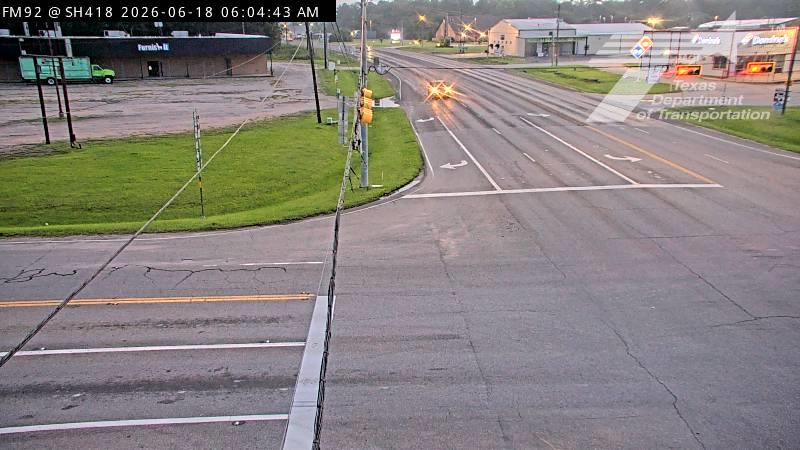
This traffic camera monitors FM-92 in Silsbee, Texas, with a northbound view.
Multiple National Weather Service alerts are active for this camera area. Review the alert details below before traveling through this corridor.
Current weather near this camera is dry, with clear sky and temperatures near 74.8 °F.
The live view is most useful for checking traffic flow, visibility, and any lane restrictions before driving through the Silsbee area.
Additional rain is expected over the next few days, which could keep pavement conditions variable in the Silsbee area.
Camera Information & Location Details
- Highway/Roadway
- FM-92
- Traffic Direction
- North
- County
- Hardin
- City
- Silsbee
- Feed Type
- Still Image
- Geographic Coordinates
- 30.36082, -94.17354
- Source Provider
- TxDOT
Real-Time Mapping
Active Weather Alert near this camera
Hazardous weather is occurring or expected soon near this camera area.
Flood Warning
Flood Warning issued June 17 at 8:12PM CDT until June 18 at 7:00PM CDT by NWS Lake Charles LA
...The Flood Warning continues for the following rivers in Texas... Louisiana... Sabine River Near Deweyville ...The Flood Warning is extended for the following rivers in Texas... Village Creek Near Kountze Additional information is available at www.weather.gov. * WHAT...Minor flooding is occurring and minor flooding is forecast. * WHERE...Village Creek near Kountze. * WHEN...Until tomorrow evening. * IMPACTS...At 17.0 feet, Water covers low spots on Willard Lake Road and Village Creek Road near Lumberton. * ADDITIONAL DETAILS... - At 7:30 PM CDT Wednesday the stage was 17.2 feet. - Recent Activity...The maximum river stage in the 24 hours ending at 7:30 PM CDT Wednesday was 17.2 feet. - Forecast...The river is expected to rise to a crest of 17.3 feet just after midnight tonight. It will then fall below flood stage tomorrow morning. - Flood stage is 17.0 feet. - http://www.weather.gov/safety/flood
- Active until
- 2026-06-19 00:00:00 UTC
- Certainty
- Observed
- Area
- Hardin, TX
Tropical Cyclone Statement
Tropical Cyclone Statement issued June 17 at 10:00PM CDT by NWS Lake Charles LA
HLSLCH This product covers Southwest Louisiana and Southeast Texas ARTHUR DEGENERATES TO A LOW PRESSURE AREA ALONG THE UPPER TEXAS COAST NEW INFORMATION --------------- * CHANGES TO WATCHES AND WARNINGS: - All watches and warnings have been canceled * CURRENT WATCHES AND WARNINGS: - None * STORM INFORMATION: - About 70 miles west of Cameron LA or about 150 miles west-southwest of Lafayette LA - 29.7N 94.5W - Storm Intensity 35 mph - Movement Northeast or 40 degrees at 9 mph SITUATION OVERVIEW ------------------ The center of Tropical Storm Arthur is now inland over the central Texas gulf coast. Nearly all of the showers and thunderstorms associated with Arthur are displaced in bands well to the east of the center across Louisiana and the northwestern gulf. All Tropical Storm Warnings have been cancelled. Wind gusts of 25-35 MPH can be expected along the southwest and south central Louisiana coasts with wind gusts up to 25 MPH inland. Long duration heavy rainfall from Arthur may still produce heavy rain and flash flooding across portions of south central Louisiana this afternoon and tonight. Rainfall totals of one half to 2 inches are expected with locally higher amounts of 2 to 6 inches possible within tropical rain bands. Coastal flooding with surge values of 1- 2 feet are peaking this afternoon and should begin to recede as tides flow out tonight. POTENTIAL IMPACTS ----------------- * FLOODING RAIN: Protect against dangerous rainfall flooding having possible significant impacts across south central Louisiana. Potential impacts include: - Moderate rainfall flooding may prompt several evacuations and rescues. - Rivers and tributaries may quickly become swollen with swifter currents and overspill their banks in a few places, especially in usually vulnerable spots. Small streams, creeks, canals, and ditches overflow. - Flood waters can enter some structures or weaken foundations. Several places may experience expanded areas of rapid inundation at underpasses, low-lying spots, and poor drainage areas. Some streets and parking lots take on moving water as storm drains and retention ponds overflow. Driving conditions become hazardous. Some road and bridge closures. Protect against locally hazardous rainfall flooding having possible limited impacts across southwest and central Louisiana. * TORNADOES: Protect against a dangerous tornado event having possible significant impacts across south central Louisiana Potential impacts include: - The occurrence of scattered tornadoes can hinder the execution of emergency plans during tropical events. - Several places may experience tornado damage with a few spots of considerable damage, power loss, and communications failures. - Locations could realize roofs torn off frame houses, mobile homes demolished, boxcars overturned, large trees snapped or uprooted, vehicles tumbled, and boats tossed about. Dangerous projectiles can add to the toll. * SURGE: Protect against locally hazardous surge having possible limited impacts across coastal portions of southeast Texas and Southwest Louisiana as well as the coastal lakes and bays. Potential impacts in this area include: - Localized inundation with storm surge flooding mainly along immediate shorelines and in low-lying spots, or in areas farther inland near where higher surge waters move ashore. - Sections of near-shore roads and parking lots become overspread with surge water. Driving conditions dangerous in places where surge water covers the road. - Moderate beach erosion. Heavy surf also breaching dunes, mainly in usually vulnerable locations. Strong rip currents. - Minor to locally moderate damage to marinas, docks, boardwalks, and piers. A few small craft broken away from moorings. Elsewhere across Southwest Louisiana and Southeast Texas, little to no impact is anticipated. * WIND: Little to no additional wind impacts expected. Protect against hazardous wind having possible limited impacts across coastal portions of southwest and south central Louisiana. Potential impacts in this area include: - Damage to porches, awnings, carports, sheds, and unanchored mobile homes. Unsecured lightweight objects blown about. - Many large tree limbs broken off. A few trees snapped or uprooted, but with greater numbers in places where trees are shallow rooted. Some fences and roadway signs blown over. - A few roads impassable from debris, particularly within urban or heavily wooded places. Hazardous driving conditions on bridges and other elevated roadways. - Scattered power and communications outages. Elsewhere across Southwest Louisiana and Southeast Texas, little to no impact is anticipated. PRECAUTIONARY/PREPAREDNESS ACTIONS ---------------------------------- * EVACUATIONS: Follow the advice of local officials. * OTHER PREPAREDNESS INFORMATION: Check on your neighbors. If necessary, help them connect with their points of contact. Be alert for potential flooding from rising rivers and streams which may have yet to crest. Remain informed of the latest river forecasts and heed any flood watches and warnings. Be alert for flooded roads which could be compromised or littered with debris. Avoid travel until water levels subside and roads have been cleared. Do not drive through places where flood waters cover the road. Turn around, don't drown! Have multiple ways to receive Tornado Warnings if issued. Consider nearby shelter options as you move about. Be ready to shelter quickly. * ADDITIONAL SOURCES OF INFORMATION: - For information on appropriate preparations see ready.gov - For information on creating an emergency plan see getagameplan.org - For additional disaster preparedness information see redcross.org NEXT UPDATE ----------- As it pertains to this event...this will be the last local statement issued by the National Weather Service in Lake Charles LA regarding the effects of tropical cyclone hazards upon the area.
- Active until
- 2026-06-18 11:00:00 UTC
- Certainty
- Likely
- Area
- Vernon; Rapides; Avoyelles; Beauregard; Allen; Evangeline; St. Landry; Lafayette; Upper St. Martin; Lower St. Martin; West Cameron; East Cameron; Northern Calcasieu; Northern Jefferson Davis; Northern Acadia; Upper Vermilion; Upper Iberia; Upper St. Mary; Southern Calcasieu; Southern Jefferson Davis; Southern Acadia; Lower Vermilion; Lower Iberia; Lower St. Mary; Tyler; Hardin; Northern Jasper; Northern Newton; Southern Jasper; Southern Newton; Upper Jefferson; Northern Orange; Lower Jefferson; Southern Orange
Heat Advisory
Heat Advisory issued June 18 at 1:24AM CDT until June 18 at 9:00PM CDT by NWS Lake Charles LA
* WHAT...Heat index values up to 107 expected. * WHERE...Hardin, Northern Jasper, Northern Newton, Southern Jasper, Southern Newton, and Tyler Counties. * WHEN...From 10 AM this morning to 9 PM CDT this evening. * IMPACTS...Hot temperatures and high humidity may cause heat illnesses.
Drink plenty of fluids, stay in an air-conditioned room, stay out of the sun, and check up on relatives and neighbors. Take extra precautions when outside. Wear lightweight and loose fitting clothing. Try to limit strenuous activities to early morning or evening. Take action when you see symptoms of heat exhaustion and heat stroke.
- Active until
- 2026-06-19 02:00:00 UTC
- Certainty
- Likely
- Area
- Tyler; Hardin; Northern Jasper; Northern Newton; Southern Jasper; Southern Newton
Current Weather near traffic camera in Silsbee, Texas
Clear sky
- Temperature
- 74.8 °F
- Feels Like
- 84.5 °F
- Humidity
- 99%
- Wind
- 1.9 mph
- Wind Direction
- SW (216°)
- Precipitation
- 0.00 inch
Forecast
- Max
- 94.7 °F
- Min
- 74.6 °F
- Precip.
- 0.04 inch
- Status
- Slight rain
- Max
- 95.3 °F
- Min
- 78.0 °F
- Precip.
- 0.00 inch
- Status
- Clear sky
- Max
- 89.2 °F
- Min
- 75.7 °F
- Precip.
- 1.15 inch
- Status
- Heavy rain
Observed at: 2026-06-18 10:00 UTC (weather data updated hourly)
Nearby Cameras
FM92 @ Payne Rd/Herndon Ave - Silsbee
Silsbee
FM-92
Direction: North
Distance: 0.3 miles
FM92 @ Roosevelt Dr/E Ave E - Silsbee
Silsbee
FM-92
Direction: North
Distance: 0.6 miles
BU96/FM92 @ E Ave G - Silsbee
Silsbee
US-96 Bus
Direction: South
Distance: 0.7 miles
BU96 @ Ave H - Silsbee
Silsbee
US-96 Bus
Direction: North
Distance: 0.8 miles
BU96 @ SH327/Ave N - Silsbee
Silsbee
US-96 Bus
Direction: West
Distance: 1.2 miles
BU96 @ W Ave P/E Ave R - Silsbee
Silsbee
US-96 Bus
Direction: North
Distance: 1.4 miles
SH327 @ Roy Hill Dr/Tennison Ln - Silsbee
Silsbee
TX-327
Direction: East
Distance: 1.5 miles
BMT - US-96 @ W Walton - Lumberton
Lumberton
US-96
Direction: North
Distance: 6.2 miles
US69/287 @ W Walton Rd - Lumberton
Lumberton
US-69
Direction: North
Distance: 6.3 miles