Live Traffic Camera: BMT - SH-73 @ Veterans Mem Bridge - Port Arthur (SWCSF) (South)
Port Arthur, Texas
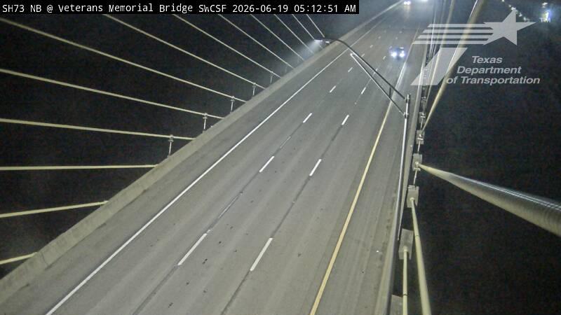
This traffic camera monitors TX-73 in Port Arthur, Texas, with a southbound view.
A National Weather Service watch is active for this camera area, meaning hazardous weather may develop even if current conditions appear calm. See the alert details below before traveling.
Current weather near this camera is dry, with clear sky and temperatures near 78.9 °F.
The live view is most useful for checking traffic flow, visibility, and any lane restrictions before driving through the Port Arthur area.
Additional rain is expected over the next few days, which could keep pavement conditions variable in the Port Arthur area.
Camera Information & Location Details
- Highway/Roadway
- TX-73
- Traffic Direction
- South
- County
- Orange
- City
- Port Arthur
- Feed Type
- Still Image
- Geographic Coordinates
- 29.97941, -93.87054
- Source Provider
- TxDOT
Real-Time Mapping
Active Weather Alert near this camera
Conditions are favorable for hazardous weather nearby, even if the current camera view looks calm.
Tropical Storm Watch
Tropical Storm Watch issued June 16 at 4:05PM CDT by NWS Lake Charles LA
* LOCATIONS AFFECTED - Nederland - Port Arthur - Sabine Pass - Sea Rim State Park * WIND - LATEST LOCAL FORECAST: Below tropical storm force wind - Peak Wind Forecast: 10-20 mph with gusts to 25 mph - THREAT TO LIFE AND PROPERTY THAT INCLUDES TYPICAL FORECAST UNCERTAINTY IN TRACK, SIZE AND INTENSITY: Potential for wind 39 to 57 mph - The wind threat has remained nearly steady from the previous assessment. - PLAN: Plan for hazardous wind of equivalent tropical storm force. - PREPARE: Efforts to protect property should now be underway. Prepare for limited wind damage. - ACT: Act now to complete preparations before the wind becomes hazardous. - POTENTIAL IMPACTS: Limited - Damage to porches, awnings, carports, sheds, and unanchored mobile homes. Unsecured lightweight objects blown about. - Many large tree limbs broken off. A few trees snapped or uprooted, but with greater numbers in places where trees are shallow rooted. Some fences and roadway signs blown over. - A few roads impassable from debris, particularly within urban or heavily wooded places. Hazardous driving conditions on bridges and other elevated roadways. - Scattered power and communications outages. * STORM SURGE - LATEST LOCAL FORECAST: Life-threatening storm surge possible - Peak Storm Surge Inundation: The potential for 2-4 feet above ground somewhere within surge prone areas - Window of concern: Begins this evening - THREAT TO LIFE AND PROPERTY THAT INCLUDES TYPICAL FORECAST UNCERTAINTY IN TRACK, SIZE AND INTENSITY: Potential for storm surge flooding greater than 3 feet above ground - The storm surge threat has remained nearly steady from the previous assessment. - PLAN: Plan for life-threatening storm surge flooding of greater than 3 feet above ground. - PREPARE: Storm surge flooding preparations should be underway. Assemble disaster supplies and know your evacuation route. - ACT: Leave if evacuation orders are given for your area. Failure to heed evacuation orders may result in the loss of your life. - POTENTIAL IMPACTS: Significant - Areas of inundation with storm surge flooding accentuated by waves. Damage to several buildings, mainly near the coast. - Sections of near-shore escape routes and secondary roads become weakened or washed out, especially in usually vulnerable low spots. - Major beach erosion with heavy surf breaching dunes. Strong and numerous rip currents. - Moderate damage to marinas, docks, boardwalks, and piers. Several small craft broken away from moorings, especially in unprotected anchorages. * FLOODING RAIN - LATEST LOCAL FORECAST: Flood Watch is in effect - Peak Rainfall Amounts: Additional 3-6 inches, with locally higher amounts - THREAT TO LIFE AND PROPERTY THAT INCLUDES TYPICAL FORECAST UNCERTAINTY IN TRACK, SIZE AND INTENSITY: Potential for major flooding rain - The flooding rain threat has remained nearly steady from the previous assessment. - PLAN: Emergency plans should include the potential for major flooding from heavy rain. Evacuations and rescues are likely. - PREPARE: Strongly consider protective actions, especially if you are in an area vulnerable to flooding. - ACT: Heed any flood watches and warnings. Failure to take action will likely result in serious injury or loss of life. - POTENTIAL IMPACTS: Extensive - Major rainfall flooding may prompt many evacuations and rescues. - Rivers and tributaries may rapidly overflow their banks in multiple places. Small streams, creeks, canals, and ditches may become dangerous rivers. Flood control systems and barriers may become stressed. - Flood waters can enter many structures within multiple communities, some structures becoming uninhabitable or washed away. Many places where flood waters may cover escape routes. Streets and parking lots become rivers of moving water with underpasses submerged. Driving conditions become dangerous. Many road and bridge closures with some weakened or washed out. * TORNADO - LATEST LOCAL FORECAST: - Situation is somewhat favorable for tornadoes - THREAT TO LIFE AND PROPERTY THAT INCLUDES TYPICAL FORECAST UNCERTAINTY IN TRACK, SIZE AND INTENSITY: Potential for a few tornadoes - The tornado threat has remained nearly steady from the previous assessment. - PLAN: Emergency plans should include the potential for a few tornadoes. - PREPARE: If your shelter is particularly vulnerable to tornadoes, prepare to relocate to safe shelter before hazardous weather arrives. - ACT: If a tornado warning is issued, be ready to shelter quickly. - POTENTIAL IMPACTS: Limited - The occurrence of isolated tornadoes can hinder the execution of emergency plans during tropical events. - A few places may experience tornado damage, along with power and communications disruptions. - Locations could realize roofs peeled off buildings, chimneys toppled, mobile homes pushed off foundations or overturned, large tree tops and branches snapped off, shallow-rooted trees knocked over, moving vehicles blown off roads, and boats pulled from moorings.
- Active until
- 2026-06-17 05:15:00 UTC
- Certainty
- Possible
- Area
- Lower Jefferson
Current Weather near traffic camera in Port Arthur, Texas
Clear sky
- Temperature
- 78.9 °F
- Feels Like
- 86.0 °F
- Humidity
- 80%
- Wind
- 4.9 mph
- Wind Direction
- SW (223°)
- Precipitation
- 0.00 inch
Forecast
- Max
- 83.8 °F
- Min
- 77.1 °F
- Precip.
- 2.72 inch
- Status
- Heavy rain
- Max
- 83.9 °F
- Min
- 77.3 °F
- Precip.
- 1.50 inch
- Status
- Heavy rain
- Max
- 87.7 °F
- Min
- 82.7 °F
- Precip.
- 0.06 inch
- Status
- Slight rain
Observed at: 2026-06-16 23:00 UTC (weather data updated hourly)
Nearby Cameras
BMT - SH-73 @ Veterans Mem Bridge - Port Arthur (SWCNF)
Port Arthur
TX-73
Direction: North
Distance: 0.0 miles
BMT - SH-73 @ Veterans Mem Bridge - Bridge City (NWCSF)
Unknown
TX-73
Direction: South
Distance: 0.1 miles
BMT - SH-73 SB @ Rainbow Bridge South
Unknown
TX-73
Direction: South
Distance: 0.1 miles
BMT - SH-73 @ Veterans Mem Bridge - Bridge City (NWCNF)
Unknown
TX-73
Direction: North
Distance: 0.1 miles
BMT - SH-73 SB @ Rainbow Bridge North
Unknown
TX-73
Direction: South
Distance: 0.2 miles
FM366 @ 32nd St - Groves
Groves
FM-366
Direction: West
Distance: 2.2 miles
FM366 @ 39th St - Groves
Groves
FM-366
Direction: West
Distance: 2.4 miles
SH73 @ Ferry Dr/ Lake St - Bridge City
Bridge City
TX-73
Direction: West
Distance: 3.3 miles
FM366 @ Hunstman - Port Neches
Unknown
FM-366
Direction: West
Distance: 3.5 miles