Live Traffic Camera: Cotulla BI35 @ SH97 (North)
Cotulla, Texas
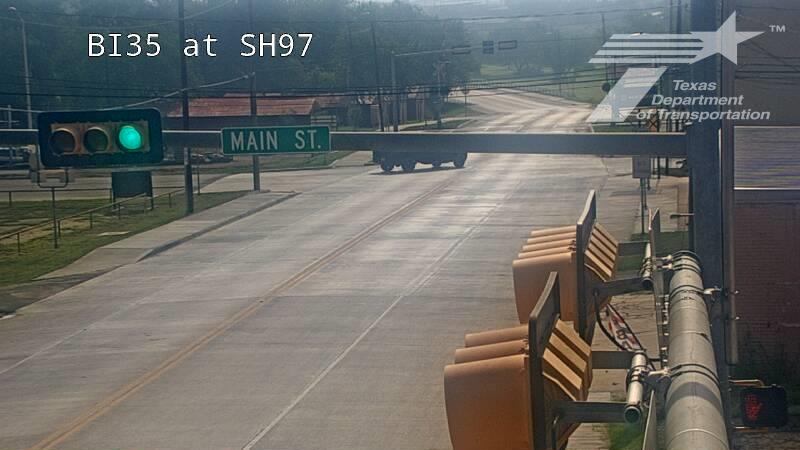
All cameras on I-35 in Texas →This traffic camera monitors I-35 in Cotulla, Texas, with a northbound view.
Multiple National Weather Service alerts are active for this camera area. Review the alert details below before traveling through this corridor.
Light rain is reported near this camera, with temperatures near 88.6 °F. Allow extra braking distance and watch for spray from nearby traffic.
A later forecast includes precipitation, including heavy rain, so conditions may change after the current camera view.
Camera Information & Location Details
- Highway/Roadway
- I-35
- Traffic Direction
- North
- County
- La Salle
- City
- Cotulla
- Feed Type
- Still Image
- Geographic Coordinates
- 28.43676, -99.23529
- Source Provider
- TxDOT
Real-Time Mapping
Active Weather Alert near this camera
Conditions are favorable for hazardous weather nearby, even if the current camera view looks calm.
Flood Watch
Flood Watch issued June 15 at 11:17AM CDT until June 18 at 7:00AM CDT by NWS Corpus Christi TX
* WHAT...Flooding caused by excessive rainfall continues to be possible. * WHERE...A portion of south Texas, including the following areas, Aransas Islands, Bee, Calhoun Islands, Coastal Aransas, Coastal Calhoun, Coastal Kleberg, Coastal Nueces, Coastal Refugio, Coastal San Patricio, Duval, Goliad, Inland Calhoun, Inland Kleberg, Inland Nueces, Inland Refugio, Inland San Patricio, Jim Wells, Kleberg Islands, La Salle, Live Oak, McMullen, Nueces Islands, Victoria and Webb. * WHEN...Through Thursday morning. * IMPACTS...Excessive runoff may result in flooding of rivers, creeks, streams, and other low-lying and flood-prone locations. Creeks and streams may rise out of their banks. Low-water crossings may be flooded. * ADDITIONAL DETAILS... - The combination of a moist tropical airmass, a stalling front, and a broad area of low pressure over eastern Mexico will result in heavy rain. Isolated pockets with rain totals of 6-8 inches or more are possible with rain rates that could exceed 2-4 inches per hour at times. There is an increased danger to lives and property due to flash flooding. Life threatening flash flooding is possible in the watch area. - http://www.weather.gov/safety/flood
You should monitor later forecasts and be alert for possible Flood Warnings. Those living in areas prone to flooding should be prepared to take action should flooding develop.
- Active until
- 2026-06-18 12:00:00 UTC
- Certainty
- Possible
- Area
- La Salle; McMullen; Live Oak; Bee; Goliad; Victoria; Webb; Duval; Jim Wells; Inland Kleberg; Inland Nueces; Inland San Patricio; Coastal Aransas; Inland Refugio; Inland Calhoun; Coastal Kleberg; Coastal Nueces; Coastal San Patricio; Aransas Islands; Coastal Refugio; Coastal Calhoun; Kleberg Islands; Nueces Islands; Calhoun Islands
Flood Watch
Flood Watch issued June 16 at 12:27PM CDT until June 18 at 7:00PM CDT by NWS Shreveport LA
* WHAT...Flooding caused by excessive rainfall continues to be possible. * WHERE...Portions of Louisiana, including the following parishes, Caldwell, Grant, La Salle, Natchitoches, Sabine and Winn and east Texas, including the following counties, Angelina, Nacogdoches, Sabine and San Augustine. * WHEN...Through Thursday evening. * IMPACTS...Excessive runoff may result in flooding of rivers, creeks, streams, and other low-lying and flood-prone locations. Flooding may occur in poor drainage and urban areas. * ADDITIONAL DETAILS... - Scattered showers and thunderstorms are expected to redevelop over portions of Deep East Texas and North Louisiana this afternoon. Additional rainfall amounts of 1-2 inches are expected across the watch area on top of the rain that fell Monday. Already saturated soils will cause any additional rain to runoff and cause flash flooding. - http://www.weather.gov/safety/flood
You should monitor later forecasts and be alert for possible Flood Warnings. Those living in areas prone to flooding should be prepared to take action should flooding develop.
- Active until
- 2026-06-19 00:00:00 UTC
- Certainty
- Possible
- Area
- Sabine; Natchitoches; Winn; Grant; Caldwell; La Salle; Nacogdoches; Angelina; San Augustine; Sabine
Flood Advisory
Flood Advisory issued June 16 at 12:25PM CDT until June 16 at 3:30PM CDT by NWS Corpus Christi TX
* WHAT...Flooding caused by excessive rainfall is expected. * WHERE...La Salle County in south central Texas... * WHEN...Until 330 PM CDT. * IMPACTS...Minor flooding in low-lying and poor drainage areas. Water over roadways. * ADDITIONAL DETAILS... - At 1225 PM CDT, Doppler radar indicated heavy rain due to thunderstorms. Minor flooding is ongoing or expected to begin shortly in the advisory area. Between 1 and 3 inches of rain have fallen. - Additional rainfall amounts of 1 to 2 inches are expected over the area. This additional rain will result in minor flooding. - Some locations that will experience flooding include... Cotulla, Los Angeles, Artesia Wells, Fort Ewell Site, Gardendale, Millett, Woodward and Fowlerton. - http://www.weather.gov/safety/flood
Turn around, don't drown when encountering flooded roads. Most flood deaths occur in vehicles. Be aware of your surroundings and do not drive on flooded roads.
- Active until
- 2026-06-16 20:30:00 UTC
- Certainty
- Likely
- Area
- La Salle, TX
Current Weather near traffic camera in Cotulla, Texas
Rain: Slight
- Temperature
- 88.6 °F
- Feels Like
- 93.0 °F
- Humidity
- 56%
- Wind
- 9.7 mph
- Wind Direction
- ENE (64°)
- Precipitation
- 0.00 inch
Forecast
- Max
- 89.9 °F
- Min
- 75.1 °F
- Precip.
- 0.56 inch
- Status
- Heavy rain
- Max
- 100.3 °F
- Min
- 74.4 °F
- Precip.
- 0.00 inch
- Status
- Clear sky
- Max
- 104.3 °F
- Min
- 78.2 °F
- Precip.
- 0.00 inch
- Status
- Clear sky
Observed at: 2026-06-16 19:00 UTC (weather data updated hourly)