Live Traffic Camera: SH36@SH21 (North)
Caldwell, Texas
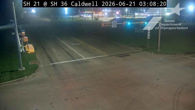
This traffic camera monitors TX-36 in Caldwell, Texas, with a northbound view.
Multiple National Weather Service alerts are active for this camera area. Review the alert details below before traveling through this corridor.
Light rain is reported near this camera, with temperatures near 84.3 °F. Allow extra braking distance and watch for spray from nearby traffic.
Additional rain is expected over the next few days, which could keep pavement conditions variable in the Caldwell area.
Camera Information & Location Details
- Highway/Roadway
- TX-36
- Traffic Direction
- North
- County
- Burleson
- City
- Caldwell
- Feed Type
- Still Image
- Geographic Coordinates
- 30.53711, -96.69363
- Source Provider
- TxDOT
Real-Time Mapping
Active Weather Alert near this camera
Hazardous weather is occurring or expected soon near this camera area.
Flood Warning
Flood Warning issued June 16 at 10:19AM CDT until June 16 at 11:49PM CDT by NWS Houston/Galveston TX
...The Flood Warning is extended for the following rivers in Texas... Davidson Creek near Lyons affecting Burleson and Washington Counties. * WHAT...Minor flooding is occurring. * WHERE...Davidson Creek near Lyons. * WHEN...Until late this evening. * IMPACTS...At 16.0 feet, Minor lowland flooding begins. * ADDITIONAL DETAILS... - At 10:00 AM CDT Tuesday the stage was 16.3 feet. - Bankfull stage is 15.0 feet. - Recent Activity...The maximum river stage in the 24 hours ending at 10:00 AM CDT Tuesday was 17.1 feet. - Forecast...The river is expected to fall below flood stage late this morning and continue falling to 3.0 feet by Sunday morning. - Flood stage is 16.0 feet. - Flood History...This crest compares to a previous crest of 16.3 feet on 05/14/2004. - http://www.weather.gov/safety/flood
Motorists should not attempt to drive around barricades or drive cars through flooded areas. Turn around, don't drown when encountering flooded roads. Most flood deaths occur in vehicles. Additional information is available at www.weather.gov/hgx. The next statement will be issued late tonight at midnight CDT.
- Active until
- 2026-06-17 04:49:00 UTC
- Certainty
- Observed
- Area
- Burleson, TX; Washington, TX
Tropical Cyclone Statement
Tropical Cyclone Statement issued June 16 at 10:59AM CDT by NWS Houston/Galveston TX
HLSHGX This product covers Southeast Texas **Potential Tropical Cyclone One Expected to Bring Heavy Rainfall to Portions of Southeast Texas** NEW INFORMATION --------------- * CHANGES TO WATCHES AND WARNINGS: - A Tropical Storm Watch has been issued for Bolivar Peninsula, Brazoria Islands, Chambers, Coastal Brazoria, Coastal Galveston, Galveston Island, and Matagorda Islands * CURRENT WATCHES AND WARNINGS: - A Tropical Storm Watch is in effect for Bolivar Peninsula, Brazoria Islands, Chambers, Coastal Brazoria, Coastal Galveston, Galveston Island, and Matagorda Islands * STORM INFORMATION: - About 250 miles southwest of Galveston TX - 27.0N 98.0W - Storm Intensity 30 mph - Movement Northeast or 45 degrees at 6 mph SITUATION OVERVIEW ------------------ Potential Tropical Cyclone 1 will move into the western Gulf and meander along the coast, before crossing into southwest Louisiana Wednesday evening. Potential impacts to southeast Texas include the prospect of locally heavy rainfall along the immediate coast, 1-3 feet of coastal flooding across the coast and along the bays, and gusts to tropical storm force along the coast. Impacts are expected to begin later in the day on Tuesday and persist into Wednesday. A Tropical Storm Watch is currently in effect for all coastal areas of SE Texas and the Gulf waters out 60 nm, with the exception of Matagorda Bay. POTENTIAL IMPACTS ----------------- * FLOODING RAIN: Prepare for life-threatening rainfall flooding having possible extensive impacts across portions of southeast Texas. Potential impacts include: - Major rainfall flooding may prompt many rescues. - Rivers and tributaries may rapidly overflow their banks in multiple places. Small streams, creeks, canals, and ditches may become dangerous rivers. Flood control systems and barriers may become stressed. - Flood waters can enter many structures within multiple communities, some structures becoming uninhabitable or washed away. Many places where flood waters may cover escape routes. Streets and parking lots become rivers of moving water with underpasses submerged. Driving conditions become dangerous. Many road and bridge closures with some weakened or washed out. Prepare for dangerous rainfall flooding having possible limited to significant impacts across southeast Texas. * WIND: Prepare for hazardous wind having possible limited impacts across the coastal portions of southeast Texas. Potential impacts in this area include: - Unsecured lightweight objects blown about. - Many large tree limbs broken off. A few trees snapped or uprooted, but with greater numbers in places where trees are shallow rooted. Some fences and roadway signs blown over. - Scattered power and communications outages. Elsewhere across Southeast Texas, little to no impact is anticipated. * SURGE: Coastal flood warnings and advisories have been issued for the immediate coast. Please reference the Coastal Hazard Message for more information. Potential impacts in this area include: - Numerous roads may be closed. Low lying property including homes, businesses, and some critical infrastructure could be inundated. Some shoreline erosion will occur. * TORNADOES: Prepare for a tornado event having possible limited impacts across southeast Texas. Potential impacts include: - The occurrence of isolated tornadoes can hinder the execution of emergency plans during tropical events. - A few places may experience tornado damage, along with power and communications disruptions. - Locations could realize roofs peeled off buildings, chimneys toppled, mobile homes pushed off foundations or overturned, large tree tops and branches snapped off, shallow-rooted trees knocked over, moving vehicles blown off roads, and small boats pulled from moorings. Elsewhere across Southeast Texas, little to no impact is anticipated. PRECAUTIONARY/PREPAREDNESS ACTIONS ---------------------------------- * EVACUATIONS: allow the advice of local officials. * OTHER PREPAREDNESS INFORMATION: Now is the time to check your emergency plan and emergency supplies kit and take necessary actions to protect your family and secure your home or business. If you live in a place particularly vulnerable to flooding, such as near the ocean or a large inland lake, in a low-lying or poor drainage area, in a valley, or near an already swollen river, plan to move to safe shelter on higher ground. Always heed the advice of local officials and comply with orders that are issued. Do not needlessly jeopardize your life or the lives of others. * ADDITIONAL SOURCES OF INFORMATION: - For information on appropriate preparations see ready.gov - For information on creating an emergency plan see getagameplan.org - For additional disaster preparedness information see redcross.org NEXT UPDATE ----------- The next local statement will be issued by the National Weather Service in Houston/Galveston TX around 4 PM CDT, or sooner if conditions warrant.
- Active until
- 2026-06-17 00:00:00 UTC
- Certainty
- Likely
- Area
- Houston; Trinity; Madison; Walker; San Jacinto; Polk; Burleson; Brazos; Washington; Grimes; Montgomery; Northern Liberty; Colorado; Austin; Waller; Inland Harris; Chambers; Wharton; Fort Bend; Inland Jackson; Inland Matagorda; Inland Brazoria; Inland Galveston; Southern Liberty; Coastal Harris; Coastal Jackson; Coastal Matagorda; Coastal Brazoria; Coastal Galveston; Matagorda Islands; Brazoria Islands; Galveston Island; Bolivar Peninsula
Current Weather near traffic camera in Caldwell, Texas
Rain: Slight
- Temperature
- 84.3 °F
- Feels Like
- 91.6 °F
- Humidity
- 72%
- Wind
- 7.4 mph
- Wind Direction
- SSE (160°)
- Precipitation
- 0.02 inch
Forecast
- Max
- 85.6 °F
- Min
- 74.2 °F
- Precip.
- 0.41 inch
- Status
- Heavy rain
- Max
- 88.8 °F
- Min
- 69.9 °F
- Precip.
- 0.02 inch
- Status
- Slight rain
- Max
- 93.3 °F
- Min
- 74.9 °F
- Precip.
- 0.00 inch
- Status
- Clear sky
Observed at: 2026-06-16 20:00 UTC (weather data updated hourly)
Nearby Cameras
FM2818@SH6
Bryan
TX-6
Direction: East
Distance: 20.6 miles
SH6@SH21
Bryan
TX-6
Direction: East
Distance: 22.7 miles
SH6@Old Reliance
Bryan
TX-6
Direction: East
Distance: 22.9 miles
SH6@William J Bryan
Bryan
TX-6
Direction: East
Distance: 23.1 miles
SH6@Briarcrest Drive
Bryan
TX-6
Direction: West
Distance: 23.4 miles
SH6@University Drive
College Station
TX-6
Direction: West
Distance: 23.9 miles
SH6@Harvey Road
College Station
TX-6
Direction: East
Distance: 24.1 miles
SH6@Rock Prairie
College Station
TX-6
Direction: East
Distance: 24.5 miles
SH6@WD Fitch
College Station
TX-6
Direction: East
Distance: 26.0 miles